Remote Sensing
We use
aerial photography
satellite images
optical scanner:
Landsat
Spot
IRS
Ikonos
aerial photography
satellite images
optical scanner:
Landsat
Spot
IRS
Ikonos
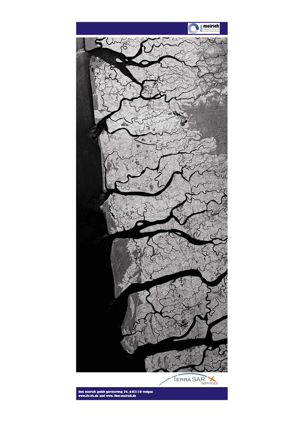
Radar
TerraSar-X
Software
ARCGIS
ERDAS Imagine
MapInfo
Measurements
GPS
We give you an overview in detail
The comparison of recent and historical images allow
- mapping of sequences in time,
- analysis of developments and
- modelling the future.
Together with common politics in Europe the requirements for qualified information about environment and security are growing.